
- Home
- Search
- Images
- Species Checklists
- US States: O-Z >
- US National Parks
- Central America
- South America
- US National Parks
- Southern Subpolar Region
|
Ramalina anceps Nyl.
 |
|
|
Family: Ramalinaceae
[Ramalina pollinaria var. anceps (Nyl.) Trevis.] ]") Frank Bungartz |
A pan-American species already reported from the Galapagos by Weber (1986). The species is corticolous, typically draping branches and twigs throughout the transition zone. It has rarely been collected and is possibly overlooked because of its similarity to R. usnea of which this taxon may just be a chemotype. Galapagos specimens of R. anceps appear overall thinner and less contorted than specimens of R. usnea, but this variability is not diagnostic morphological character to reliably distinguish the two taxa. The validity at species level should therefore be re-assessed on the basis of material from their whole (pan-American) distribution range. Weber (1986, p. 482) already stated: “...the lines that separate these taxa are not clear to me...” Selected specimens examined. Ecuador: Galápagos: Isabela Island, Volcán Alcedo, along the trail going up the E-slope, at the NW-side of the trail, 0˚ 24’ 5” S, 91˚ 2’ 36” W, alt. 420 m, arid zone; open Bursera graveolens stand with an occasional Pisonia floribunda and Zanthoxylum fagara and shrubs of Macraea laricifolia and Waltheria ovata, on bark, twigs of Zanthoxylum fagara; semi-shaded, wind- and rain-exposed, 09 iii 2006, F. Bungartz 4342 (CDS no. 28426); Pinta Island, along the trail up to the summit from the S-coast, 0˚ 34’ 22” N, 90˚ 45’ 3” W, alt. 329 m, transition zone; open woodland of Zanthoxylum fagara, Pisonia floribunda, and few Trema micrantha; grasses and Justicia galapagana in the understory, on bark, twigs of Zanthoxylum fagara; sunny, wind- and rain-exposed, 27 ii 2007, F. Bungartz 5856 (CDS no. 33532); San Cristóbal Island, Cerro Partido along trail from entrance to Cerro Pelado to Ripioso, 0˚ 51’ 23” S, 89˚ 27’ 37” W, alt. 376 m, transition zone; rocky SW-exposed slope of hill with Jasminocereus thouarsii, Clerodendrum molle var. glabrescens, Psidium galapageium, Bromeliaceae and ferns growing in rock crevices, on bark, twigs of Psidium galapageium, S-exposed; sunny, wind- and rain-exposed, 28 iv 2007, F. Bungartz 6586 (CDS no. 34806); Santa Cruz Island, farm along the southern part of the loop road from Bellavista to Garrapatero, 0˚ 41’ 12” S, 90˚ 18’ 22” W, alt. 214 m, agricultural zone; Coffee and Guava plantations, on bark, branches and trunk of recently logged Cedrela odorata tree on the ground; sunny, wind- and rain-exposed, 19 ii 2006, F. Bungartz 3733 (CDS no. 27593); Santiago Island, along the trail from Bucanero to Jaboncillos, ca. 3 km SE of Bucanero , 0˚ 10’ 52” S, 90˚ 48’ 33” W, alt. 362 m, transition zone; open woodland of large Bursera graveolens and smaller Psidium galapageium trees, grassland and basalt boulders in between, on bark, Bursera, 22 iii 2006, A. Aptroot 65394 (CDS no. 31980). from: |
 R. Howe [Bungartz, F. 5170 (CDS 29383)]") Frank Bungartz ]") Frank Bungartz ]") Frank Bungartz   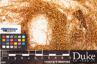 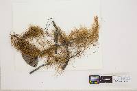 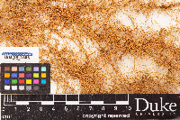    ") The New York Botanical Garden 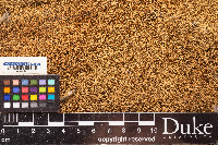 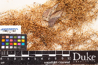 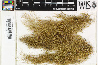  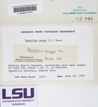 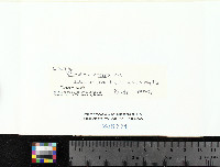 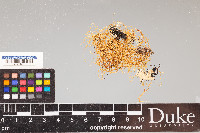 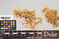      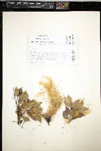   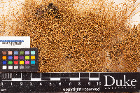  ") The New York Botanical Garden 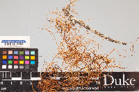    ") The New York Botanical Garden  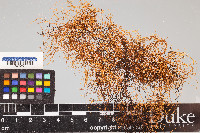 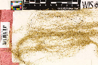    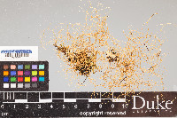  |
|

![]()
![]()

![]()
![]()
![]()
![]()
![]()